Housing Scheme Layout Plan With 25 Ft And 40 Ft Roads Design
Description
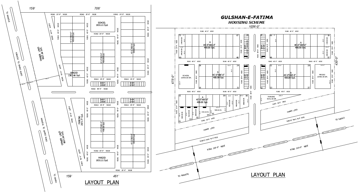
This AutoCAD DWG drawing presents a detailed housing scheme urban design layout plan prepared with accurate zoning, plot distribution, and infrastructure planning. The layout includes residential plots measuring 45x80 feet with an area of approximately 4000 square yards, arranged in well-defined blocks. Internal roads of 25 feet, 30 feet, and 40 feet in width are clearly marked, ensuring smooth traffic circulation and efficient access to all plots. The plan also shows a main road of 220 feet in width, service roads of 40 feet in width, and clear connectivity to surrounding areas such as Karachi and Sakro. Plot boundaries, road dimensions, and site measurements are precisely labeled for planning approval and construction reference.
The drawing further integrates essential public amenities, including a school area of about 6480 square feet, masjid spaces measuring approximately 1831 square yards and 14880 square feet, parking areas around 8312 square feet, and designated shop blocks. Owner land, open land, and reserved zones are clearly demarcated to support organized development. Orientation symbols, plot numbering, and road width annotations enhance clarity for design coordination. This AutoCAD DWG file is suitable for architects, civil engineers, planners, and developers seeking a complete housing scheme layout with precise measurements, infrastructure details, and integrated community facilities for urban development projects.

Uploaded by:
Eiz
Luna